College Creek Then and Now
Following up on the last post, I am going to post a snippet from a 1913 Maryland Geological Survey map of Anne Arundel County. But first things first. Apparently, what we now know as College Creek was then called "Dorsey's Creek."
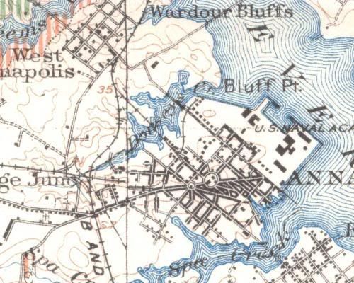
1913
The road crossing the tip of the Creek is Clay Street, maintaining basically the same configuration as it does today. At that point, however, it was likely a short bridge crossing. The headwaters forked, with one branch heading south toward West Street, and the other heading west, towards what is now Admiral Heights. Former rail lines, running east-west and north-south can be seen criss-crossing the confluence.
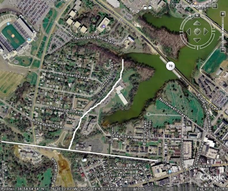
Below is a current aerial, with the historic rail lines drawn, roughly, in white.
2005
There is clearly a huge area of fill where the Glenwood Apartments sit, as well, interestingly, to the north, where Calvary Methodist Church and St. John's College are currently located.
Labels: Annapolis
posted by N.D. Sproll @ 9:07 PM
0 comments
![]()

0 Comments:
Post a Comment
<< Home